1
MONITORING OF MOUNTAINOUS AREAS USING SIMULATED IMAGES TO KOMPSAT-Ⅱ
Eun-Mi Chang and Soo-Hyun Shin
3GCORE Institute, [email protected]
ABSTRACT:
More than 70 percent of terrestrial territory of Korea is mountainous areas where degradation becomes serious year by year due to illegal tombs, expanding golf courses and stone mine development. We elaborate the potential usage of high resolution image for the monitoring of the phenomena. We made the classification of tombs and the statistical radiometric characteristics of graves were identified from this project. The graves could be classified to 4 groups from the field survey. As compared with grouping data after clustering and discriminant analysis, the two results coincided with each other. Object-oriented classification algorithm for feature extraction was theoretically researched in this project. And we did a pilot project, which was performed with mixed methods. That is, the conventional methods such as unsupervised and supervised classification were mixed up with the new method for feature extraction, object-oriented classification method. This methodology showed about 60% classification accuracy for extracting tombs from satellite imagery. The extraction of tombs' geographical coordinates and graves themselves from satellite image was performed in this project. The stone mines and golf courses are extracted by NDVI and GVI. The accuracy of classification was around 89 percent. The location accuracy showed extraction of tombs from one-meter resolution image is cheaper and quicker way than GPS method. Finally we interviewed local government officers and made analyses on the current situation of mountainous area management and potential usage of KOMPSAT-II images. Based on the requirement analysis, we developed software, which is to management and monitoring system for mountainous area for local government.
KEY WORDS: Monitoring, tomb, KOMPSAT-II, Local government
1. PURPOSES AND RATIONALES
Tombs have had a negative effect on the landscape and caused an ineffective use of national land recently. For this reason, the systematic management of the tombs is necessary. One of the purposes of this project is to identify tombs' geographical coordinates from ortho- image and to analysis algorithms for extracting tombs on the satellite image. Illegal tombs, golf courses, stone mines and other activities degrading the values of mountainous areas may be monitored by satellite imagery instead of GPS surveys or field works.
So this study aims to verify the accuracy of position of tombs and that of classified land uses using KOMPSAT- II simulated images and to design database for officers in local governments to apply the new method to business work as routine and finally to develop monitoring system for mountainous areas with GIS data.
2. STUDY SCOPES
First, the geographical coordinates from ortho-image was compared with those of GPS survey. The digital maps were used to produce Digital Elevation Model and ortho-rectify raw satellite image. And ground control points were extracted from digital maps. We ascertained that the location residual error was about from 2m to 3m.
As taking a mound over grave into consideration, the location residual error will be about from 4m to 5m.
Second, the classification of tombs and the statistical radiometric characteristics of graves were identified from this project. We think those procedures will be necessary to extract tombs with semi-automatic method from satellite imagery. The graves could be classified to 4 groups from the field survey. As compared with grouping data after clustering and discriminant analysis, the two results coincided with each other.
Third, object-oriented classification algorithm for feature extraction was theoretically researched in this project. And we did a pilot project which was performed with mixed methods. That is, the conventional methods such as unsupervised and supervised classification were mixed up with the new method for feature extraction, object-oriented classification method. This methodology showed about 60% classification accuracy for extracting tombs from satellite imagery. The extraction of tombs' geographical coordinates and graves themselves from satellite image was performed.
Fourth, we classified mountainous areas for golf courses and stone mines using different image processing software to compare the accuracy of classification modules. Most of classification modules have similar values of accuracy for the golf courses, which means that
2 it is not necessary for us to develop a new additional logic
for the classification at this time.
Fifth, we gathered some list of questionnaire to local government officers and interviewed them to find out the reality of problems of mountainous areas. Each local government has different problems. For example, small volcano mounds have been degraded by Telecommunication Towers in Jeju province.
Sixth, we have designed and built new software to integrate all the forms of official report related to tombs, golf course and stone mine management with background of ortho-rectified satellite images and GIS data. The functions of the software were tested by officers of Taean Gun.
3. RESULTS Table 1. the First year
targets contents results
tombs monitoring for sample site
- field work and GPS measuring for Gyunggi Province Goyang city Paju City.
- work for verification of position accuracy analyses of
work and design for
software preview of previous studies
on monitoring change on base
point and technologies
- Check out all the new materials and new policies of Nation Geographic Intelligence Agency which is in charge of national geographic information data
analyses of algorithms
feature extraction algorithms
- result comparison by different classification methods
- content report step by step during the classifications
ortho-photos generation
- with accuracy of less than two meter error
making simulated
ortho- imagery
verification of outside
- article presentation in annual conference of Korean Geographic Association
- article delivered on coastal management using IKONOS data with some field work - presentation in ACRS 2003
field work and interview
interview on the reality
- GPS and imagery recognition
- current stage of law reinforcement on the tomb management
analysis of local government
response
review and analysis on the questionnaire
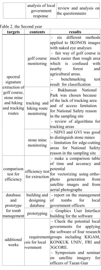
Table 2. the Second year
targets contents results
golf course monitoring
- six different methods applied to IKONOS images with naked eye analyses - fair way of golf course is much easier than rough area which is confused with nearby forest and agricultural areas.
- benchmarking test result for classification
tracking and hiking route
monitoring
- Bukhansan National Park was chosen because of the lack of tracking area and of access limitation for National Safety reason in the sampling site
- review of algorithms for tracking areas
spectral signature extraction of
golf course, stone mine and hiking and tracking
routes
stone mine monitoring
- NDVI and GVI was good to distinguish stone mines - limitation for edge-cutting areas for National Safety reason in the sampling site
comparison test for efficiency
efficiency test for extraction
- make a comparison table of time and accuracy and potential
for vectorizing using ortho- photo generation from satellite images and from aerial photographs
building and designing
database
- report on the management of tombs for local government officers
database and prototype
for tomb
management prototyping - Graphics User Interface building for the software
additional works
requirement ysis for local overnment
- Check the potential local governments for applying the software of four research groups including KIGAM, KONKUK UNIV, FRI and 3GCORE.
- Symposium and seminar on satellite imagery for officers of Taean Gun
3 Table 3. the third year
targets contents results
finish management
system
- current information system for local government is being transferred from Client/
server Program to web based program
- separate standalone program finished and expected to connect the upgraded system later
try expert system
- shade and road in mountainous area are not critical for spectral signature, so the semi- automatic. methods applied
integrate the previous results
- GUI integration for the two years' results
feature extraction and
pattern extraction
- point base tomb extraction
- the other features are extracted by the existent algorithms
mplete integrated management
system
friendly GUI development
- reporting form provided - access Database was used for database
- register the software patent
4. FURTHER APPLICATION OF THE RESULTS
The ways to apply all the results of this study are as follows.
This monitoring system will provide the decision support system for land use and facilities and land cover which keep changing through the time. Not only city officers but only officers in rural areas will able to figure out spatial reconstruction in the future and to decide the ways not to degrade the natural landscapes.
High-resolution imagery will enable people whoever to see changing land instantly and timely and to support national policy with some scientific foundation. It is possible to reduce the unintended overdevelopment of new city development and construction of roads and harbors and expect people to make an appropriate planning and to execute the plan later with concrete background.
The ultimate goal of this study is to make local government officers use the high resolution data for preventing mountainous area from degrading and make policies efficiency. Therefore, classification of urban land use planning should be done with some imagery data regularly and the results should be compared to check the effects of policies on land developments.
5. REFERENCE
Firestone L., Rupert S., Olson J., and Mueller W., 1996, Automated Feature Extraction: The Key to Future Productivity, Photogrammetric Engineering and Remote Sensing, 62(7), pp.671-674.
Franklin, S.E., Wulder, M.A., and Gerylo, G.R., 2001, Texture Analysis of IKONOS Panchromatic Data for Douglas-fir Forest Age Class Separability in British Columbia, International Journal of Remote Sensing, 22(13), pp.2627-2632.
Franklin S.E., Maudie A.J., and Lavigne M.B., 2001, Using Spatial Co-occurrence Texture to Increase Forest Structure and Species Composition Classification Accuracy, Photogrammetric Engineering and Remote Sensing, 67(7), pp. 849-855.
Geneletti, D. and Gorte, B.G.H., 2003, A Method for Object-oriented Land Cover Classification Combining Landsat TM Data and Aerial Photographs, International Journal of Remote Sensing, 24(6), pp.1273-1286.
Gong J. and Li D., 2000, Object-oriented and Integrated Spatial Data Model for Managing Image, DEM, and Vector Data, Photogrammetric Engineering and Remote Sensing, 66(5), pp.619-623.
Kiema, J.B.K., 2002, Texture Analysis and Data Fusion in the Extraction of Topographic Objects from Satellite Imagery, International Journal of Remote Sensing, 23(4), pp.767-776.
Smith, A.M.S., 2002, Texture Based Feature Extraction: Application to Burn Scar Detection in Earth Observation Satellite Sensor Imagery, International Journal of Remote Sensing, 23(8), pp.1733-1739.
Usery, E. L., 1996, A Feature-Based Geographic Information System Model, Photogrammetric Engineering and Remote Sensing, 62(7), pp. 833-838.