A Study on Soil Characteristics of Paddy Fields with Re-established Soils
Yeon-Kyu Sonn, Yong-Hee Moon
1, Yong-Seon Zhang*, Kang-Ho Jung, Hye-Rae Cho, Byung-Keun Hyun, Kook-Sik Shin, and Kyeong-Hwa Han
Division of Soil and Fertilizer, National Academy of Agricultural Science, Wanju, Korea
1
Land Management & Urban Research Division, Korea Research Institute for Human Settlements, 254 Simindaero, Dongan-gu, Anyang-si, Gyeonggi-do, 431-712, Korea
(Received: June 8 2015, Revised: June 24 2015, Accepted: June 24 2015)
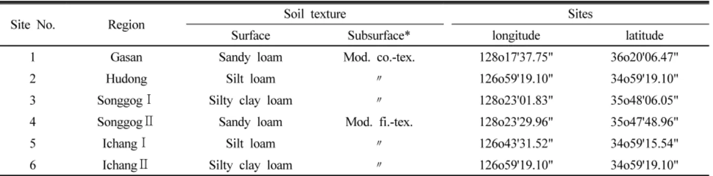
Six study sites in Gumi, Goryeong in Gyeongbuk province and Naju in Jeonnam province were selected to investigate soil properties of poorly drained horizons in paddy soils. The horizons were re-established layers which were parent material layers originated from fluvial deposits. Topsoil layers were differentiated from piled parent materials while soil structure of the topsoil layer was massive with striated microstructure.
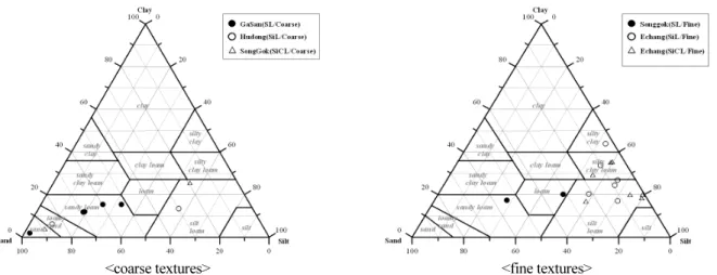
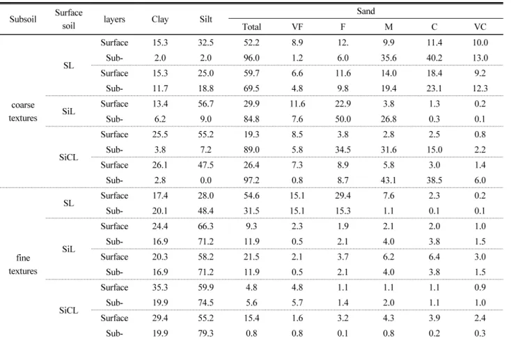
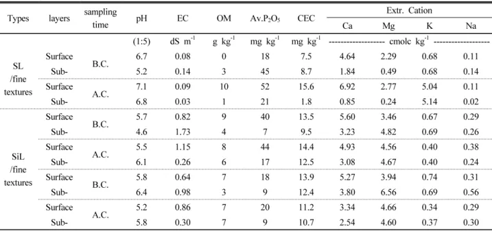
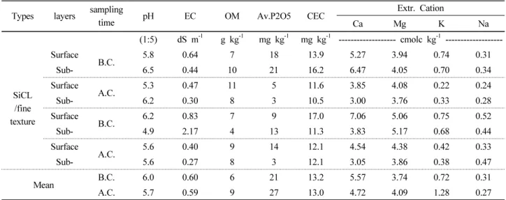
Compaction at soil re-establishment and a lack of structure and aggregate development in these soils may cause the limitation of vertical water movement and result in poorly drained horizons. Soil samples were taken from paddy fields with top soils of sandy loam, silt loam and silty clay loam and re-established soils of coarse and fine texture. The samples were taken from each horizon for the analyses of soil chemical and mineral properties. Soils with re-established soils of coarse texture had greater amounts of sands from top soil texture distributions, while soils with fine texture had greater amounts of silts. Chemical properties of top soils were analyzed from rice cultivated soils at the time of re-establishments and one year after the re-establishments.
The coarse texture of the re-established horizons decreased in EC values from 0.23 to 0.11 (dS m -1 ), available phosphate values from 112 to 54 (mg kg -1 ), and exchangeable Ca values from 6.6 to 4.9 (cmol c kg -1 ). On the other hand, soils with fine texture showed decrease only in pH and exchangeable Ca values. Especially, organic matter and available phosphate contents showed heterogeneous distributions from each horizon. This result may be caused by mixture of plough layer and subsurface layer during and consolidation. Hydraulic conductivity values were low at the boundaries of top soil and parent material layers except SL/coarse soil.
Soil microstructure was massive structure without soil clods or pores and showed striated structure. Therefore, re-established paddy fields with fluvial deposits as parent material layers showed limited vertical movements of soil water because of occurrence of compacted layers and less-development of soil clods and aggregates.
Key words: Pan, Bt, Micro-morphology, Structure
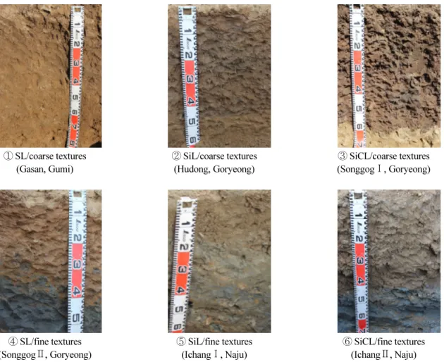
① SL/coarse textures (Gasan, Gumi)
② SiL/coarse textures (Hudong, Goryeong)
③ SiCL/coarse textures (SonggogⅠ,
Goryeong)
④ SL/fine textures (SonggogⅡ,
Goryeong)
⑤ SiL/fine textures (IchangⅠ, Naju)
⑥ SiCL/fine textures (IchangⅡ, Naju)
Hydraulic conductivity of surface soils of various anthropogenic soil types.
1)
*Corresponding author : Phone: +82632382431, Fax: +82632383822, E-mail: [email protected]
§