Comparison of Three Land Cover Classification Algorithms - ISODATA, SMA, and SOM - for the Monitoring of North
Korea with MODIS Multi-temporal Data
Do-hyung Kim*
†, Seung-gyu Jeong**, and Chong-hwa Park***
*Environmental Planning Institute, Seoul National University
**Environmental Planning Institute, Seoul National University
***Graduate School of Environmental Studies, Seoul National University
Abstract : The objective of this research was to investigate the optimal land cover classification algorithm for the monitoring of North Korea with MODIS multi-temporal data based on monthly phenological characteristics. Three frequently used land cover classification algorithms, ISODATA
1), SMA
2), and SOM
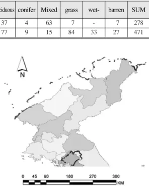
3)were employed for this study; the land cover categories were forest, grass, agricultural, wetland, barren, built-up, and water body.
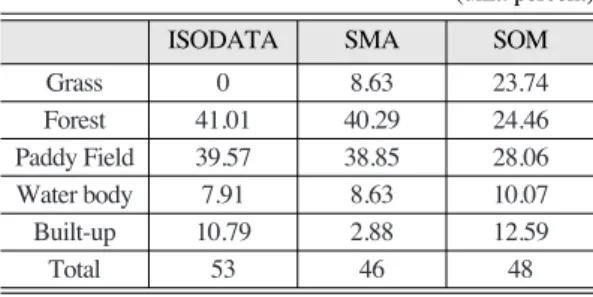
The outcomes of the study can be summarized as follows. First, the overall classification accuracy of ISODATA, SMA, and SOM was 69.03%, 64.28%, and 73.57%, respectively. Second, ISODATA and SMA resulted in a higher classification accuracy of forest and agricultural categories, but SOM performed better for the built-up area, bare soil, grassland, and water. A possible explanation for this difference would be related to the difference of sensitivity against the vegetation activity. This would be related to the capability of SOM to express all of their values without any loss of data by maintaining the topology between pixels of primitive data after classification, while ISODATA and SMA retain limited amount of data after normalization process. Third, we can conclude that SOM is the best algorithm for monitoring the land cover change of North Korea.
Key Words : ISODATA, SMA, SOM, MODIS, Multi-temporal Imagery, land cover classification.
Received 4 June 2007; Accepted 12 June 2007.
†