1. INTRODUCTION
After the successful launch of the Global Positioning System (GPS) by the United States (US), space powers, such as Russia, Europe, China, Japan, and India, have recognized the importance of Radio Navigation Satellite Service (RNSS) and launched their own satellite navigation systems or modernized existing systems to provide the improved positioning, navigation and timing (PNT) services.
After declaring Full Operation Capability (FOC) in 1995, the US announced a plan to modernize GPS in 2000.
Their modernization process is underway across the space segment and control segment, with a focus on providing new navigation signals and new types of navigation messages.
GPS “Block IIR-M” satellites transmit second-generation
Development of MATLAB-based Signal Performance Analysis Software for New RNSS Signal Design
Kahee Han
1, Jong-Hoon Won
2†1
Autonomous Navigation Lab., Inha University, Incheon 22212, Korea
2
Department of Electrical Engineering, Inha University, Incheon 22212, Korea
ABSTRACT
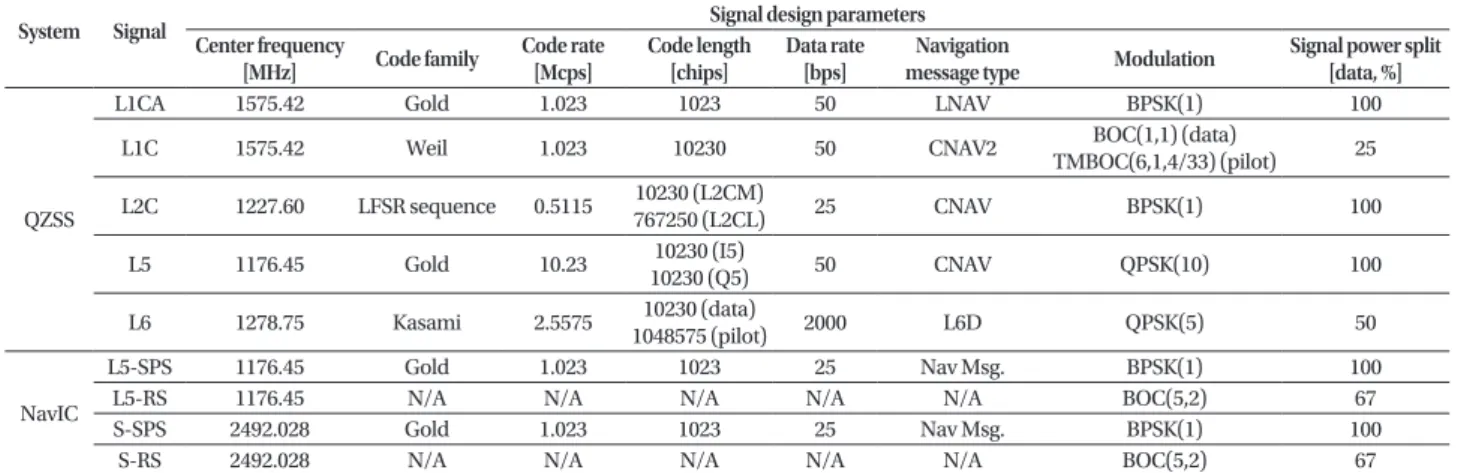
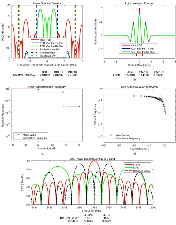
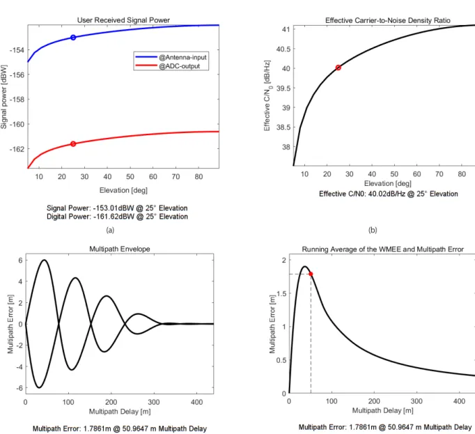
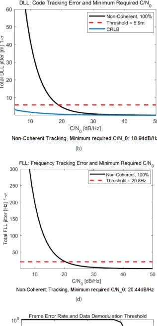
The design of new navigation signals is a key factor in building new satellite navigation systems and/or modernizing existing legacy systems. Navigation signal design involves selecting candidate groups and evaluating and analyzing their signal performances. This process can be easily performed through software simulation especially at the beginning of the development phase. The analytical signal performance analysis software introduced in this study is implemented based on equations between the signal design parameters of Radio Navigation Satellite Service (RNSS) and the navigation signal figures- of-merit (FoMs). Therefore, this study briefly summarizes the RNSS signal design parameters and FoMs before introducing the developed software. After that, we explain the operating sequence of the implemented software including the Graphical User Interface (GUI), and calculate the FoMs of an example scenario to verify the feasibility of the software operations.
Keywords: RNSS, figure of merit, signal design parameter, analytical simulator
civilian signal (L2C) and military signal (L1/2 M) as well as legacy navigation signals L1 C/A and L1/L2 P(Y), “Block IIF” satellites transmit additionally third-generation civilian signal (L5), and “Block III/IIIF” satellites, which are under development, are scheduled to additionally transmit fourth- generation civilian signal (L1C) (NOAA 2019). Following GPS, Russia’s GLObal NAvigation Satellite System (GLONASS) also configured a fully operational constellation (24 first- generation GLONASS satellites) and started to provide services to civilian and military users. However, in the 1990s, the decline in funding for the space industry due to their economic regression degraded its performance. Since then, the Russian government has launched the modernization programs “Global Navigation System for 2002-2011”
and “GLONASS Sustainment, Development and Use for 2012-2020”, aiming to improve positioning performance (Revnivykh 2012). Conventional GLONASS satellites only transmitted FDMA signals, but now CDMA navigation signals (L3OC) developed by the two distinct programs are planned to be transmitted in the L3 band through “GLONASS-M” and
“GLONASS-K” satellites. Additionally, the next-generation GLONASS-K2 satellites are scheduled to transmit new CDMA Received Nov 14, 2019 Revised Nov 25, 2019 Accepted Dec 02, 2019
†