Journal of the Korean Society of Surveying, Geodesy, Photogrammetry and Cartography Vol. 33, No. 1, 63-70, 2015
http://dx.doi.org/10.7848/ksgpc.2015.33.1.63
Hyperion과 ALI 영상의 융합을 위한 블록 기반의 융합기법 평가
Evaluation of Block-based Sharpening Algorithms for Fusion
of Hyperion and ALI Imagery
김예지1)· 최재완2)
Kim, Yeji · Choi, Jaewan
Abstract
An Image fusion, or Pansharpening is a methodology of increasing the spatial resolution of image with low- spatial resolution using high-spatial resolution images. In this paper, we have performed an image fusion of hyperspectral imagery by using panchromatic image with high-spatial resolution, multispectral and hyperspectral images with low-spatial resolution, which had been acquired by ALI and Hyperion of EO-1 satellite sensors. The study has been mainly focused on evaluating performance of fusion process following to the image fusion methodology of the block association, which had applied to ALI and Hyperion dataset by considering spectral characteristics between multispectral and hyperspectral images. The results from experiments have been identified that the proposed algorithm efficiently improved the spatial resolution and minimized spectral distortion comparing with results from a fusion of the only panchromatic and hyperspectral images and the existing block-based fusion method. Through the study in a proposed algorithm, we could concluded in that those applications of airborne hyperspectral sensors and various hyperspectral satellite sensors will be launched at future by enlarge its usages.
Keywords : Spatial Resolution, Block-Based Fusion, Hyperspectral Imagery, ALI, Hyperion
초 록
영상융합 기법은 고해상도 영상을 이용하여 저해상도 영상의 공간해상도를 증대시키는 방법이다. 본 논문에서
는 EO-1 위성에 탑재된 ALI 센서와 Hyperion 센서로부터 취득된 고해상도 흑백영상, 저해상도 다중분광 영상 및 초분광 영상을 활용한 초분광 영상의 융합기법에 대한 연구를 수행하였다. 특히, 초분광 영상과 다중분광 영상의 특성을 고려하여 초분광 영상의 블록을 구성하여 ALI 및 Hyperion 영상에 적용하고, 이에 따른 영상융합 기법의
성능을 평가하고자 하였다. 실험결과, 고해상도 흑백영상만을 사용한 융합결과와 비교하여 저해상도 다중분광 영
상을 활용한 블록기반의 융합기법이 공간해상도를 효율적으로 향상시킬 수 있음을 확인하였으며, 제안된 융합기법 이 기존의 블록기반 융합기법과 비교하여 분광왜곡을 최소화시킬 수 있음을 확인하였다. 이를 통해, 향후 발사될
다양한 초분광 위성 및 항공기 초분광 센서의 활용을 증대시킬 수 있을 것으로 판단된다.
핵심어 : 공간해상도, 블록 기반의 융합기법, 초분광영상, ALI, Hyperion
63 ISSN 1598-4850(Print) ISSN 2288-260X(Online) Original article
Received 2015. 02. 11, Revised 2015. 02. 23, Accepted 2015. 02. 24
1) Department of Civil and Environmental Engineering, Seoul National University, Korea (E-mail: [email protected])
2) Corresponding Author, Member, School of Civil Engineering, Chungbuk National University, Korea (E-mail: [email protected])
This is an Open Access article distributed under the terms of the Creative Commons Attribution Non-Commercial License (http://
creativecommons.org/licenses/by-nc/3.0) which permits unrestricted non-commercial use, distribution, and reproduction in any medium,
provided the original work is properly cited.
Journal of the Korean Society of Surveying, Geodesy, Photogrammetry and Cartography, Vol. 33, No. 1, 63-70, 2015
1. 서 론
센서의 기술발전에 따라서 최근의 인공위성 센서들은 높은 공간해상도 (spatial resolution)를 가지는 영상의 취득과, 다양 한 분광파장대(spectral wavelength)의 정보를 취득할 수 있는 다중분광(multispectral), 초분광(hyperspectral) 영상의 취득 이라는 2가지 관점에서 발전되고 있다. 특히, 10㎚ 이내의 좁 고(narrow), 연속적인(continuous) 분광파장대의 영상을 획득 할 수 있는 초분광영상은 토지피복지도의 생성, 지형 및 지물 의 변화탐지(change detection), 표적탐지(target detection) 등 과 같은 원격탐사 활용분야에 효과적으로 적용할 수 있는 가 능성을 지닌다.
현재, 국내에서 취득가능한 초분광 영상은 CASI(Compact Airborne Spectrographic Imager) 및 AISA(Airborne Imaging Spectrometer for Applications) 등과 같은 항공 초분광 센 서를 활용한 방법과 NASA(National Aeronautics and Space Administration)의 EO-1(Earth Observing-1) 위성 에 탑재된 Hyperion 센서에서 얻어진 영상이 대표적이 며, 향후, HISUI(Hyperspectral Imager SUIte), EnMAP (Environmental Mapping and Analysis Program) 등과 같은 다양한 초분광 센서를 탑재한 인공위성이 발사될 예정이다 (Yamamoto et al., 2012).
이에 따라 고해상도의 다중분광영상과 흑백영상을 이용하 여 초분광 영상의 공간해상도를 증대시키는 영상 융합(image fusion, sharpening)에 대한 연구가 최근 들어 진행되고 있다.
ALI 영상을 이용하여 Hyperion 영상의 공간해상도를 증가시 킬 경우, 영상 분류 및 변화탐지 알고리즘 적용에 있어서 해 상도 증가에 따른 정확도 개선이 가능할 것으로 판단된다. 국 외의 경우, Cetin and Musaoglu(2009)는 초분광 영상과 전정 영상의 융합에 대하여 기존의 융합방법을 비교하는 연구를 수행하였으며, Yokoya et al.(2012)은 분광혼합기법(spectral mixture analysis)을 기반으로 하는 초분광 영상융합 기법인 CNMF(Coupled Nonnegative Matrix Factorization)을 제안 하고, 이를 초분광영상에 적용하여 알고리즘의 성능을 평가 하였다. Sylla et al.(2014)은 기존의 고해상도 위성영상에 적 용되는 ARSIS(Amelioration de la Resolution Spatiale par
Injection de Structures) 기법을 블록(block) 기반의 융합 기법으로 확장하여 낮은 공간해상도를 가진 다중분광 및 초분 광 영상을 융합하여 초분광 영상의 공간해상도를 개선하였 다. 국내의 경우, Choi et al.(2006)이 2단계 분광혼합기법 기 반의 융합 방법을 제안하고, 이를 Hyperion과 ALI 흑백영상 에 적용한 바 있으며, Kim(2014)은 CNMF의 알고리즘을 수
정한 융합 기법을 제안하고, 초분광 영상의 분광파장대를 벗 어나는 다중분광영상을 이용하여 초분광 영상의 공간해상도 를 개선하는 연구를 진행하기도 하였다.
본 논문에서는 NASA의 EO-1 위성에 탑재된 ALI 및 Hyperion 센서에서 취득된 영상의 융합을 위하여 초분광 영 상과 다중분광 영상의 블록 구성에 따른 영상융합 기법을 제 안하였다 . 이를 위하여, Sylla et al.(2014)이 제안한 블록 기 반의 영상융합 기법을 개선하여 Hyperion 영상에 적합한 블 록생성 방법을 제안하였다. 해당기법은 서울지역의 ALI 및 Hyperion 영상에 적용하였으며, 블록 구성에 따른 영상 융합 의 결과를 분석하고자 하였다.
2. 연구 자료 및 대상지역
2.1 사용 데이터
앞서 언급한 바와 같이, 본 논문에서는 EO-1 위성에 탑 재된 ALI 및 Hyperion 센서를 활용하여 실험을 수행하였 다 . ALI 센서는 10m 공간해상도의 흑백영상과 30m 공간해 상도의 다중분광영상을 제공하며, Hyperion 센서는 30m 공간해상도를 지니는 VNIR(VIsible and Near-InfraRed)과 SWIR(Short-Wave InfraRed) 파장영역의 초분광영상을 제 공한다 . EO-1 위성 내 센서들의 특성은 Table 1과 같다.
ALI Hyperion
spectral range 400~2400㎚
spatial resolution
(panchromatic) 10m (multispectral) 30m
30m
swath width 36km 7.6km
spectral resolution (nm)
480~690 (panchromatic) 433~453(MS1) 450~515(MS2) 525~605(MS3) 630~690(MS4) 775~805(MS5) 845~895(MS6) 1200~1300(MS7)
1550~1750(MS8) 2080~2350(MS9)
400~1000 (VNIR) 1000~2400
(SWIR)
total number of
bands 10 242
Table 1. Specifications of the EO-1 satellite
Evaluation of Block-based Sharpening Algorithms for Fusion of Hyperion and ALI imagery
65
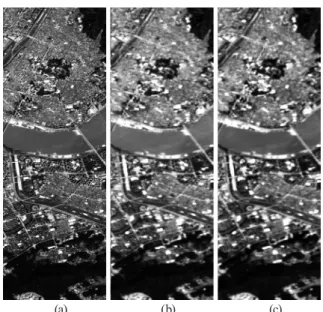
2.2 대상지역본 연구에서는 2010년 9월 7일에 촬영된 서울지역의 ALI 및 Hyperion 영상을 사용하였다. 다양한 종류의 토지피복이 존재하는 지역에 대하여 실험을 수행하기 위하여 한강을 포 함한 지역을 실험대상지역으로 선정하였으며, 실험에 사용한 해당지역은 Fig. 1과 같다.
2.3 전처리
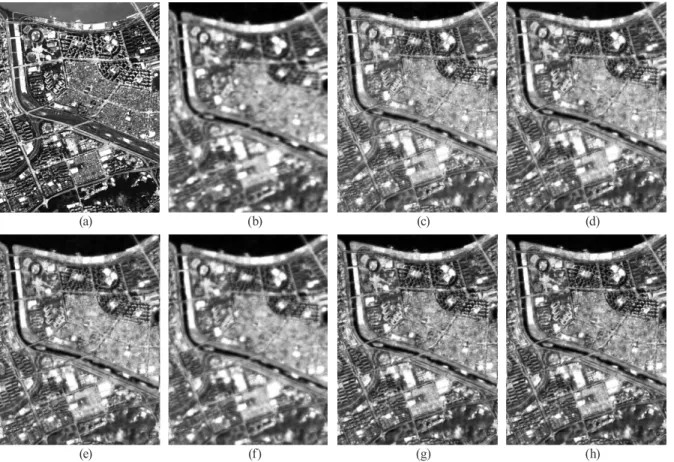
ALI 및 Hyperion 영상의 기하학적 특성과 분광적인 특성을 동일하게 조정하기 위한 전처리를 수행하였다. 첫 번째로, 융 합영상을 생성하기 위해서는 ALI 및 Hyperion 영상은 동일한 좌표체계를 지녀야 한다. 이를 위하여, GCP(Ground Control Point)를 활용한 기하보정을 수행하여 두 영상의 좌표를 일치 시켰다 . 또한, ALI 및 Hyperion 영상은 DN(Digital Number) 값으로 이루어져 있기 때문에, 대기보정(atmospheric correction) 과정을 수행하여, 영상의 DN 값을 분광반사 율 (reflectance)로 변환하였다. 대기보정의 경우, ALI 다중 분광영상과 Hyperion 영상은 ATCOR(Atmospheric and Topographic CORrection) 모듈을 활용하였으며, ALI 흑백 영상은 NASA에서 제공한 모델식을 활용하여 TOA(Top Of Atmospheric) 분광반사율로 변환하였다(Brook and Ben-Dor 2011). 한편, 분광반사율로 변환된 초분광 영상의 일부 밴드 들은 Fig. 2와 같이 노이즈를 포함하고 있는 경우가 존재하기 때문에 최종적으로 노이즈로 판단되는 해당 밴드들을 제거
하여 총 151개의 초분광 밴드자료를 실험 자료로 사용하였다.
3. 연구 방법