1. Introduction
Water resource disasters are occurring frequently worldwide due to climate change, and the extent of such disasters is also expanding; According to the 2018
IPCC report, global temperatures have risen by about 1°C due to human industrial activity, it can rise to about 1.5°C between 2030 and 2052. As a result, disasters such as heavy rain, heat waves, and droughts can occur frequently and cause a lot of damage. South Korea has
The Application of the Next-generation Medium Satellite C-band Radar Images
in Environmental Field Works
Hyeon-gyeong Han
1)· Moungjin Lee
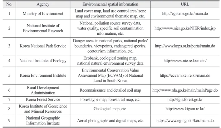
2)†Abstract: Numerous water disasters have recently occurred all over the world, including South Korea, due to global climate change in recent years. As water-related disasters occur extensively and their sites are difficult for people to access, it is necessary to monitor them using satellites. The Ministry of Environment and K-water plan to launch the next-generation medium satellite No. 5 (water resource/water disaster satellite) equipped with C-band synthetic aperture radar (SAR) in 2025. C-band SAR has the advantage of being able to observe water resources twice a day at a high resolution both day and night, regardless of weather conditions. Currently, RADARSAT-2 and Sentinel-1 equipped with C-band SAR achieve the purpose of their launch and are used in various environmental fields such as forest structure detection and coastline change monitoring, as well as for unique purposes including the detection of flooding, drought and soil moisture change, utilizing the advantages of SAR. As such, this study aimed to analyze the characteristics of the next-generation medium satellite No. 5 and its application in environmental fields. Our findings showed that it can be used to improve the degree of precision of existing environmental spatial information such as the classification accuracy of land cover map in environmental field works. It also enables us to observe forests and water resources in North Korea that are difficult to access geographically. It is ultimately expected that this will enable the monitoring of the whole Korean Peninsula in various environmental fields, and help in relevant responses and policy supports.
Key Words: C-band, SAR, Water hazards, Water resources, Environmental spatial information
https://doi.org/10.7780/kjrs.2019.35.4.10 ISSN 2287-9307 (Online)
Letter
Received August 14, 2019; Revised August 20, 2019; Accepted August 26, 2019; Published online August 27, 2019
1)
Researcher, Center for Environment Assessment Monitoring, Korea Environment Institute
2)
Research Fellow, Center for Environment Assessment Monitoring, Korea Environment Institute
†