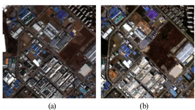
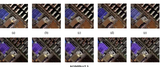
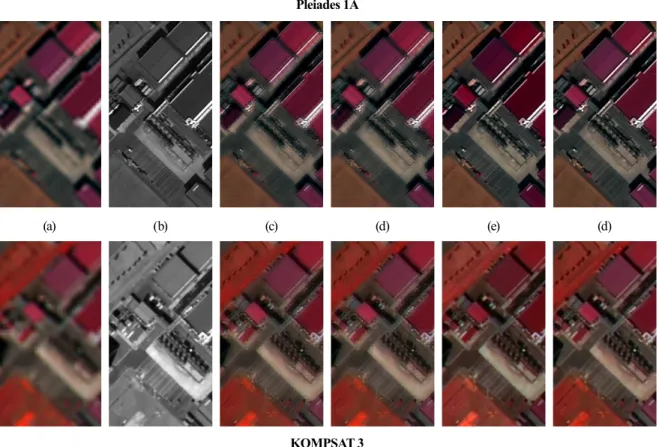
Image Fusion Methods for Multispectral and Panchromatic Images of Pleiades and KOMPSAT 3 Satellites
10
0
0
전체 글
(2)
(3)
(4)
(6)
(7)
(8)
(9)
(10)
수치

+2

관련 문서
GDP impact of COVID-19 spread, public health response, and economic policies. Virus spread and public
Micro- and nano-sized pores were formed on the surface of the alloy using PEO and anodization methods, and the pore shape change according to the Zr
This same argument can be used to show that the complementary virtual work of redundant member forces is zero not only for truss elements but for members of any other
– Total project cost is not known before construction begins – Less owner input: Owner struggles to keep
– No dock facilities (major market Southeast Asia) – Lower construction cost (lower labor cost). – Closer to feedstock/raw materials
skeleton bond energy differences of monomer, oligomers, and polymer. Skeletal bond energy difference
For any axis—angle pair (AK, 0), there is another pair, namely, (_AK, —0), which results in the same orientation in space, with the same rotation matrix describing it.
The use of cells and biological molecules or cellular and biomolecular processes to solve problems and make
