1. Introduction
At present, new concepts or new computing paradigm in the web are emerged; in the geospatial domain as a kind of the mainstream in information technology communities, those have been adopted and adapted in the viewpoint of standardization and industrial needs. Furthermore, this trend is converged in the paradigm of web 2.0 and more, under the basic slogan of openness, sharing, and participation. While, in the other words, applications in web 2.0 emphasizes on interactivity by mean of social
computing and networking. Technically, this aspect in the geospatial web or geo web meets web 2.0 computing patterns: service-oriented architecture, software as a service, mashup, rich user experience, structured information and so forth. Fig. 1 shows comparative summary of web paradigm.
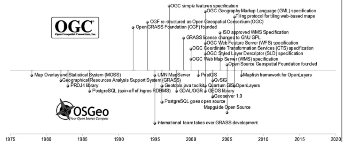
The geospatial web or geoweb is a term that implies the merging of geographical information with the abstract information that currently dominates the Internet. As well, it is extended that the geospatial web has a profound impact on managing knowledge, structuring workflows within and across organizations,
Basic Elements and Implication of Software Metadata in the Intelligent Geospatial Web
Kiwon Lee
†Dept. of Information System Engineering, Hansung University
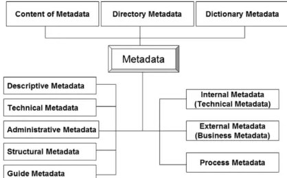
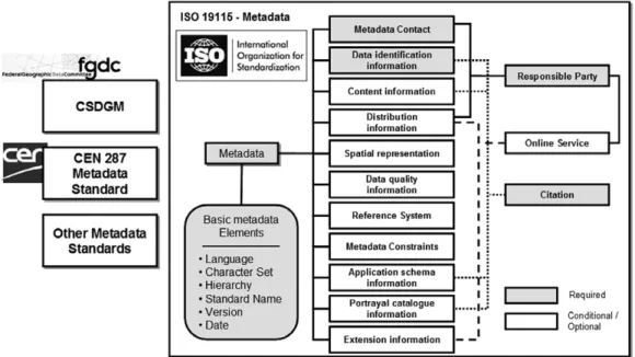
Abstract : During over decades, metadata on spatial data have been developed, and they have been widely applied at the national and international metadata standards such as file structure, format, and data model. However, in the web 2.0 paradigm toward user participation and openness, sources and contents of geospatial products are also diversified, not being limited to well-organized and structured data sets or databases. Especially, software products in both open source software and commercially packaged software are considered into important resources in the geospatial domain. But there are no reports or studies regarding software metadata from the side of software engineering or information technology, till now. The motivation of this study is based on practical needs to build search engine in the intelligent geospatial web.
Brief review on current metadata standards is presented, and necessity for software metadata is discussed as well as related works. Basic elements, initially considered, of software metadata are presented. This work is the first attempt for software metadata, although it just covers geospatial software products. Further practical works to meet industrial demands need to actual applications of software metadata.
Key Words : Geospatial Web, Metadata, Standards, Software.
Received December 21, 2009; Revised December 24, 2009; Accepted December 25, 2009.
†