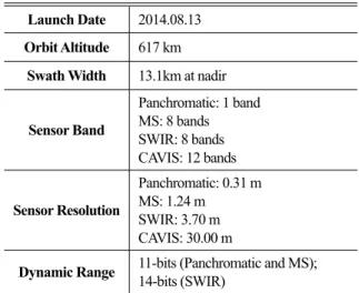
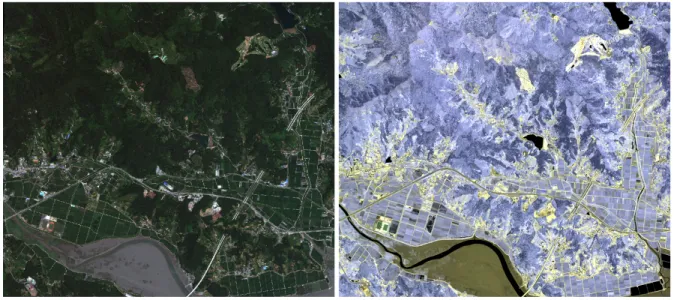
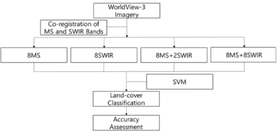
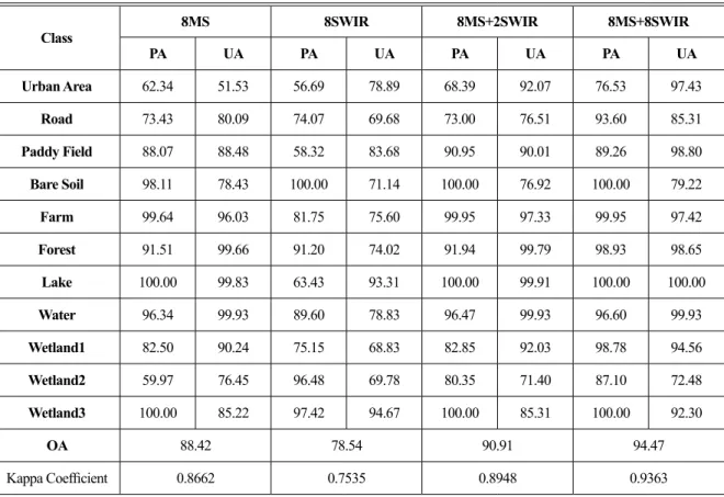
Effect Analysis of Worldview-3 SWIR Bands for Wetland Classification in Suncheon Bay, South Korea
9
0
0
전체 글
(2)
(3)
(4)
(5)
(6)
(7)
(8)
(9)
수치

+2
관련 문서
A Systematics and Ecological Notes on Marine Polychaetes (Annelida, Polychaeta) from Korea, with the Secondary Production of Hediste japonica Population in Suncheon
Learning Korean is essential to understand Korean culture and live in Korea with fewer obstacles. Fortunately, there are many institutions in Korea offering Korean language
Sources: metal plating, rechargeable batteries, smelting (제련), refining, mine drainage, industrial wastewater, corrosion of galvanized pipe in the water distribution
This is because compared with the free-year English classes, the general semester English classes consisted of teacher oriented grammar class and reading
First, uniformity in the form of cooperative classes recommended by the Korea Culture, Arts and Education Promotion Agency, the main body of the support
So, the result of the comparative analysis in the social studies object, curriculums and textbooks of South and North Korea indicate that the differences
In this study, water flow system of Danghang Bay, which has the narrow and long topographical characteristics with the narrow bay mouth and its flow
Dilute water means separating water molecules and make it more difficult for them to
