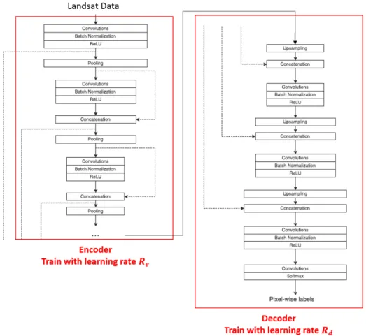
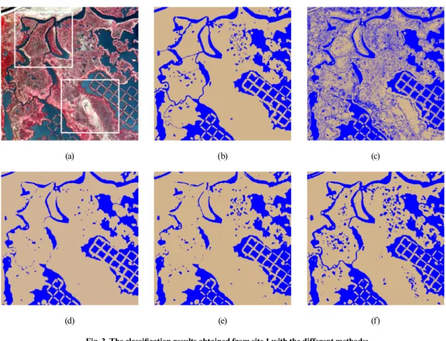
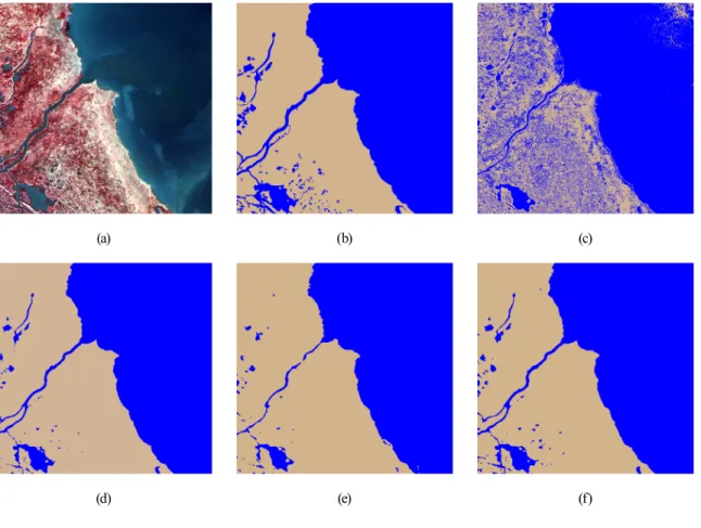
Surface Water Mapping of Remote Sensing Data Using Pre-Trained Fully Convolutional Network
10
0
0
전체 글
(2)
(3)
(5)
(6)
(7)
(8)
(9)
수치

관련 문서
The purpose of this research was to suggest the water quality improvement in streams by evaluating the distribution characteristics of organics and ammonia nitrogen
– In order to investigate the interaction between neurons in the network, patterning the small number of neurons is necessary.. – The electrical connectivity
§ 고속의 처리를 요구하는 IP 보안 프로토콜(IPSec)에 사용 l 암호키 관리: 네트워크에서 소요되는 전체 키의 개수가 많음 l 암호키 분배: 사전에 비밀키가 안전하게
위하여 연결설정(SYN) 요청 à 위조된 IP 주소로 부터 응답(ACK)을 받을 때까지 대기 q 위조된 대량의 연결설정(SYN) 요청 패킷이 수신되면 서버의 대기
• A network added between a protected network and an external network, in order to provide an additional layer of security.!. • 허용할 network 접속과 허용하지
1 John Owen, Justification by Faith Alone, in The Works of John Owen, ed. John Bolt, trans. Scott Clark, "Do This and Live: Christ's Active Obedience as the
In summary, in order to detect malicious flows in a target network traffic, the flow correlation index between the target network traffic and the seed flow is calculated,
Based on the initial refined division of the network into clusters by k-means++, nodes of each network cluster can negotiate internally to select the head node of each
