1. Introduction
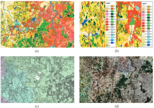
Land cover maps are 2D representations of physical materials on the surface of the earth, valuable as a scientific basis for establishing environmental policies, and are also used as research materials for ecosystem surveys in academics (Park et al., 2007). The Ministry of Environment of Korea established a classified land
cover map for the entire country in 2010 and has since performed a continuous revision project. However, as land cover is changing faster than the mapping update cycle due to urban development and climate change, land cover maps must be updated to provide timely and accurate land cover data describing surface changes (Jo et al., 2019).
Land cover mapping and update technology using
Establishment of Priority Update Area
for Land Coverage Classification Using Orthoimages and Serial Cadastral Maps
Junyoung Song
1)·Taeyeon Won
1)·Su Min Jo
2)·Yang Dam Eo
3)†·Jin Sue Park
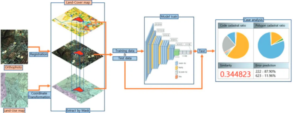
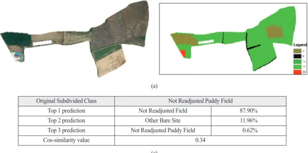
4)Abstract: This paper introduces a method of selecting priority update areas for subdivided land cover maps by training orthoimages and serial cadastral maps in a deep learning model. For the experiment, orthoimages and serial cadastral maps were obtained from the National Spatial Data Infrastructure Portal. Based on the VGG- 16 model, 51,470 images were trained on 33 subdivided classifications within the experimental area and an accuracy evaluation was conducted. The overall accuracy was 61.42%. In addition, using the differences in the classification prediction probability of the misclassified polygon and the cosine similarity that numerically expresses the similarity of the land category features with the original subdivided land cover class, the cases were classified and the areas in which the boundary setting was incorrect and in which the image itself was determined to have a problem were identified as the priority update polygons that should be checked by operators.
Key Words: Deep learning, Land cover map, Orthoimage, Serial cadastral map, VGG-16 Article
Received August 9, 2021; Revised August 19, 2021; Accepted August 25, 2021; Published online August 27, 2021
1)
Master Student, Department of Advanced Technology Fusion, Konkuk University
2)
Undergraduate student, Department of Civil and Environmental Engineering, Konkuk University
3)
Professor, Department of Civil and Environmental Engineering, Konkuk University
4)
Staff, Project Development Division, ALLforLAND.Co.Ltd
†