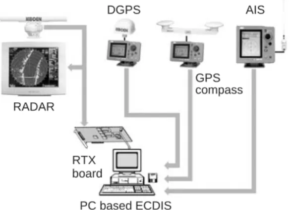
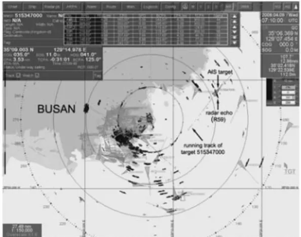
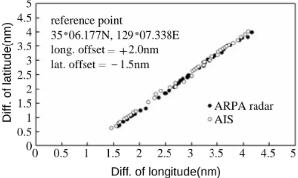
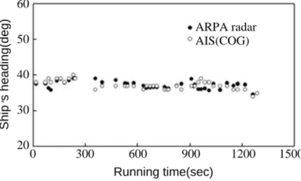
Real-time position tracking of traffic ships by ARPA radar and AIS in Busan Harbor, Korea
10
0
0
전체 글
(2)
(3)
(4)
(5)
(6)
(7)
( ___ Ni
(9)
(10)
수치
+2
관련 문서
Independently of the question of seduction, our patient, while he was a child, found in his sister a n inconvenient com- petitor for the good opinion of
The Dutch physicist Pieter Zeeman showed the spectral lines emitted by atoms in a magnetic field split into multiple energy levels... With no magnetic field to align them,
Modern Physics for Scientists and Engineers International Edition,
Five days later, on 15 January 1975, the Portuguese government signed an agreement with the MPLA, FNLA and UNITA providing for Angola to receive its independence on 11
In the current context, where the interconnectedness of the global economy has intensified greatly and the importance of a collective response to
웹 표준을 지원하는 플랫폼에서 큰 수정없이 실행 가능함 패키징을 통해 다양한 기기를 위한 앱을 작성할 수 있음 네이티브 앱과
_____ culture appears to be attractive (도시의) to the
The index is calculated with the latest 5-year auction data of 400 selected Classic, Modern, and Contemporary Chinese painting artists from major auction houses..
