1. Introduction
Thunderstorm refers to a well-developed deep convection cloud and accompanied by strong rain, gusts, lightning, and thunder (Lutgens et al., 1995). In
Korea, three sides are surrounded by the sea, and high mountain ranges are located in the north-south direction in the eastern region of the inland, and small mountain ranges derived from this are formed east-west, so the meteorological phenomena vary greatly depending on
Improvement of Thunderstorm Detection Method Using GK2A/AMI, RADAR, Lightning,
and Numerical Model Data
Ha-Yeong Yu
1)· Myoung-Seok Suh
2)†· Seoung-Oh Ryu
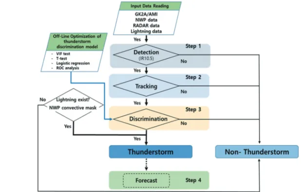
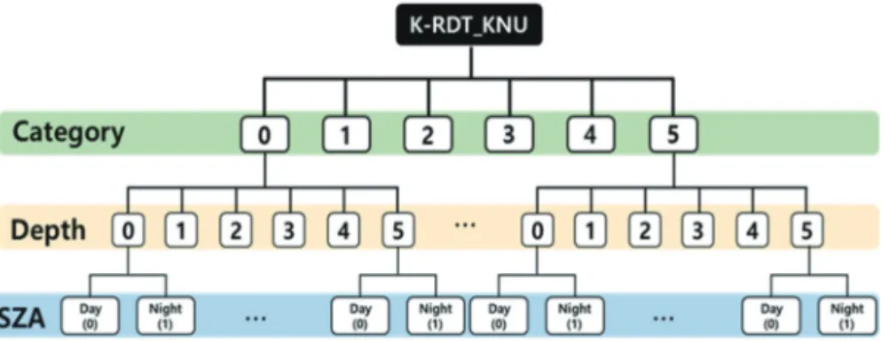
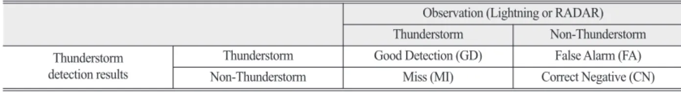
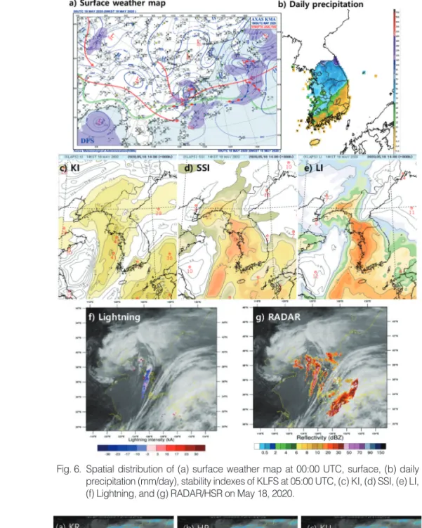
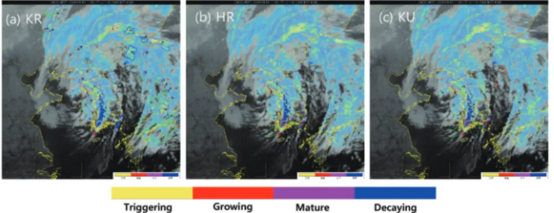
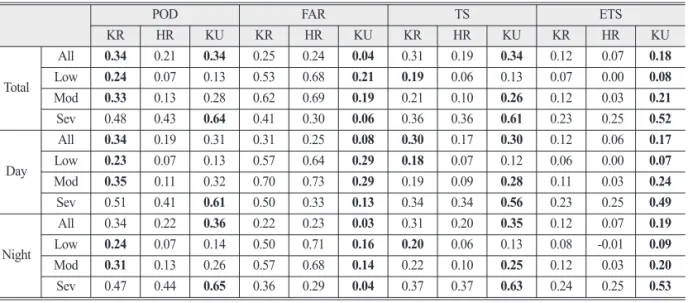
1)Abstract: To detect thunderstorms occurring in Korea, National Meteorological Satellite Center (NMSC) also introduced the rapid-development thunderstorm (RDT) algorithm developed by EUMETSAT. At NMCS, the H-RDT (HR) based on the Himawari-8 satellite and the K-RDT (KR) which combines the GK2A convection initiation output with the RDT were developed. In this study, we optimized the KR (KU) to improve the detection level of thunderstorms occurring in Korea. For this, we used all available data, such as GK2A/AMI, RADAR, lightning, and numerical model data from the recent two years (2019-2020). The machine learning of logistic regression and stepwise variable selection was used to optimize the KU algorithms. For considering the developing stages and duration time of thunderstorms, and data availability of GK2A/AMI, a total of 72 types of detection algorithms were developed. The level of detection of the KR, HR, and KU was evaluated qualitatively and quantitatively using lightning and RADAR data. Visual inspection using the lightning and RADAR data showed that all three algorithms detect thunderstorms that occurred in Korea well. However, the level of detection differs according to the lightning frequency and day/night, and the higher the frequency of lightning, the higher the detection level is. And the level of detection is generally higher at night than day. The quantitative verification of KU using lightning (RADAR) data showed that POD and FAR are 0.70 (0.34) and 0.57 (0.04), respectively.
The verification results showed that the detection level of KU is slightly better than that of KR and HR.
Key Words: Thunderstorm, Machine Learning, K-RDT, GK2A/AMI, Numerical model data, Lightning, RADAR Korean Journal of Remote Sensing, Vol.37, No.1, 2021, pp.41~55
https://doi.org/10.7780/kjrs.2021.37.1.4 ISSN 1225-6161 ( Print )
ISSN 2287-9307 (Online)
Article
Received February 8, 2021; Revised February 8, 2021; Accepted February 17, 2021; Published online February 19, 2021
1)
Master Student, Department of Atmospheric Science, Kongju National University
2)
Professor, Department of Atmospheric Science, Kongju National University
†