GIS를 이용한 도심지 대기오염 측정망 최적위치 선정에 대한 연구 : 서울특별
시를 대상으로
Study on Optimal Location of Air Pollution Monitoring Networks
in Urban Area Using GIS : Focused on the case of Seoul City
Ayoung Kim a,1 , Changhee Kwon b,*
a
Department of Beauty of Hansei University of Hansero 30, Gunpo Gyeonggi - do 435-742, Republic of Korea
b
Department of Beauty of Hansei University of Hansero 30, Gunpo Gyeonggi - do 435-742, Republic of Korea
* Corresponding author. Tel. 82-31-450-5254. Fax. 82-31-450-3172.
ARTICLE HISTORY Recieved Aug. 29, 2016 Revised Sep. 24, 2016 Accepted Dec. 06, 2016
A B S T R A C T KEYWORDS
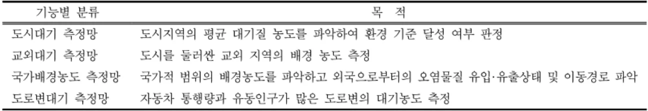
Micro dust is closely related to real life. Especially, the micro dust forecasting system is being implemented from February 2014. Reliability of data through air pollution monitoring network is important. The Ministry of Environment operates 506 air pollution monitoring networks (11 types) to analyze national air quality and establish air policies.
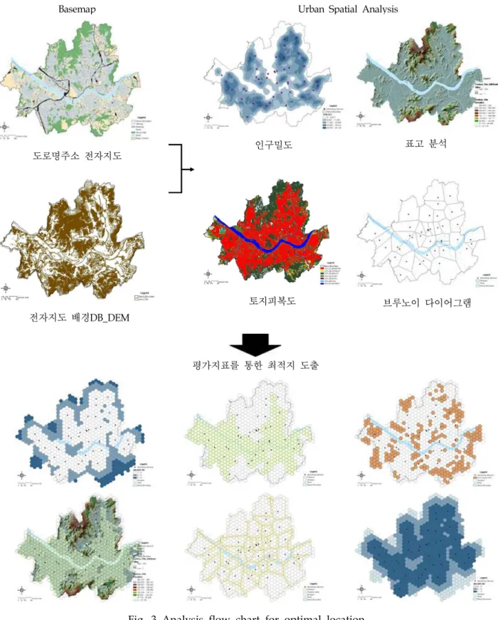
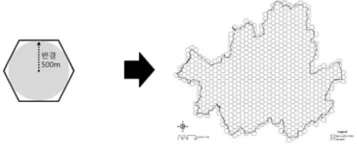
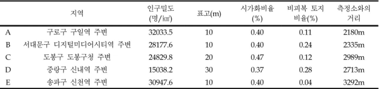
However, there is not enough system to confirm and check the site suitability of the measurement site. Therefore, this study analyzes urban space using GIS. Assess the appropriateness and equity of air pollution measurement facilities. The final goal is to reflect the results of the analysis into the Seoul Metropolitan Air Pollution Monitoring Network Installation Plan.
Micro dust Environmental disaster Air monitoring network GIS
Urban Spatial Analysis
미세먼지는 실생활과 밀접한 관련이 있으며 특히 , 2014년 2월부터 대국민 환경서비스 제 공의 일환으로 미세먼지 예보제를 시행중에 있어 , 대기오염 측정망을 통한 미세먼지 측정 자료의 신뢰성을 확보할 필요성이 대두되었다 . 환경부에서는 국가 대기질 파악 및 대기정 책수립을 위해 대기오염측정망 (11종 506개소)을 운영 중이다. 그러나 현재 측정소 입지 선 정 과정과 적합성을 확인 및 점검하는 체계가 미흡하다 . 따라서 본 연구에서는 GIS를 활용 한 도시 공간분석을 통해 대기오염 측정시설의 적절성 및 입지 형평성 등을 평가하고자 한 다 . 분석 결과를 통해 향후 서울시 대기오염 측정망 설치 계획에 반영 될 수 있도록 측정망 의 최적입지를 도출함을 최종 목적으로 한다 .
미세먼지 환경재난 대기측정망 GIS
도시공간분석
ⓒ 2016 Korea Society of Disaster Information All rights reserved
1976-2208 ⓒ 2016 Korea Society of Disaster Information All rights reserved.
http://dx.doi.org/10.15683/kosdi.2016.12.31.358