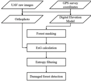
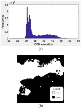
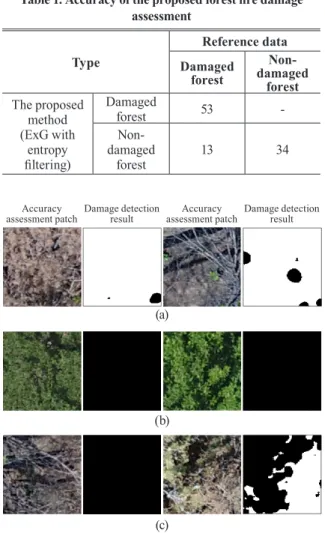
Forest Fire Damage Assessment Using UAV Images: A Case Study on Goseong-Sokcho Forest Fire in 2019
7
0
0
전체 글
(2)
(3)
(4)
(5)
(6)
(7)
수치

관련 문서
